Rockstar has not published an official square-mile measurement for the GTA VI map. Claims that Leonida is exactly a particular multiple of GTA V usually depend on community reconstruction, perspective estimates or information outside official material.
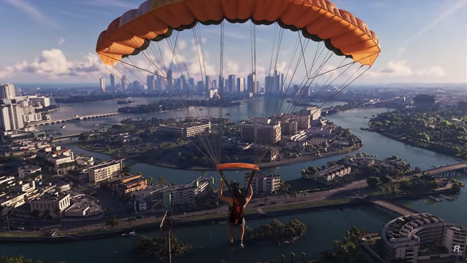
The aerial footage still tells us something useful. Waterways divide districts, bridges concentrate road travel and the distant skyline remains visible across several developed islands.
The confirmed world is broader than Vice City
Rockstar has named Vice City, Leonida Keys, Grassrivers, Port Gellhorn, Ambrosia and Mount Kalaga National Park. These regions cover urban coast, islands, wetlands, industry and higher forested land.
Geographic variety affects perceived size. A route interrupted by water, bridges or rough terrain can feel longer and more distinctive than the same distance across a uniform road grid.
What the parachute view shows
The foreground contains lower neighborhoods and waterways, while a dense tower cluster forms the far destination. Several bridge connections are visible, along with roads that curve around water rather than following a simple city grid.
Atmospheric haze and lens perspective make distant objects appear closer together. That is why counting pixels cannot produce a dependable real-world area.
How to read community maps
A strong fan map labels confirmed landmarks, probable matches and guessed connections separately. It also changes when new footage disproves an earlier placement.
A weak map presents every inferred road with the same confidence. Community mapping is valuable research, but it should not be mistaken for a finished official map.
The honest answer
Leonida visibly contains several large and varied regions, but its playable boundary and exact area remain unknown. The experience of scale will also depend on travel speed, density, verticality and accessible interiors.
Until an official map or measurable final game exists, a precise number answers the search query more neatly than the evidence allows.
Sources checked